2016
NS7696 : River confluence
taken 8 years ago, 3 km from Nyadd, Stirling, Scotland
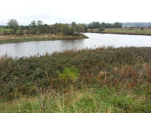
River confluence
The River Teith (distant) joins the Forth (left) at this point, although on the ground it looks perhaps like it should be the other way around.
 Map © Crown Copyright")
TIP: Click the map for more Large scale mapping
- Grid Square
- NS7696, 12 images (more nearby 🔍)
- Photographer
- Callum Black (more nearby)
- Date Taken
- Friday, 14 October, 2016 (more nearby)
- Submitted
- Tuesday, 14 February, 2017
- Subject Location
-
OSGB36:
 NS 7693 9614 [10m precision]
WGS84: 56:8.5222N 3:58.9344W - Camera Location
-
OSGB36: NS 7697 9608
- View Direction
- North-northwest (about 337 degrees)