2016
SD2502 : Crosby Channel Navigation Marker C10
taken 8 years ago, near to Taylor's Bank [other Features], Sefton, Great Britain
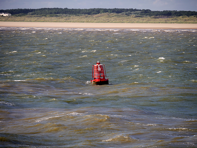
Crosby Channel Navigation Marker C10
The shipping route approaching Liverpool follows the Queen's Channel, the Crosby Channel, and the River Mersey. The channels, which are well marked by numbered and lit buoyage, run between tall training banks that channel the scouring effects of the tide to keep the deep water approaches to Liverpool open. There are sandbanks and relatively shallow waters side either of the channel.
C20 is one of the red (port) markers, Its position is shown on navigation charts as(approx) 53º31N, 3º07.75W +/-50m.
C20 is one of the red (port) markers, Its position is shown on navigation charts as(approx) 53º31N, 3º07.75W +/-50m.
 Map © Crown Copyright")
TIP: Click the map for more Large scale mapping
- Grid Square
- SD2502, 3 images (more nearby 🔍)
- Photographer
- David Dixon (more nearby)
- Date Taken
- Wednesday, 13 July, 2016 (more nearby)
- Submitted
- Wednesday, 15 February, 2017
- Subject Location
-
OSGB36:
 SD 252 028 [100m precision]
WGS84: 53:30.9974N 3:7.7550W - Camera Location
-
OSGB36: SD 252 023
- View Direction
- NORTH (about 0 degrees)