SK9136 : Memorial Shelter, Wyndham Park
taken 7 years ago, near to Grantham, Lincolnshire, England
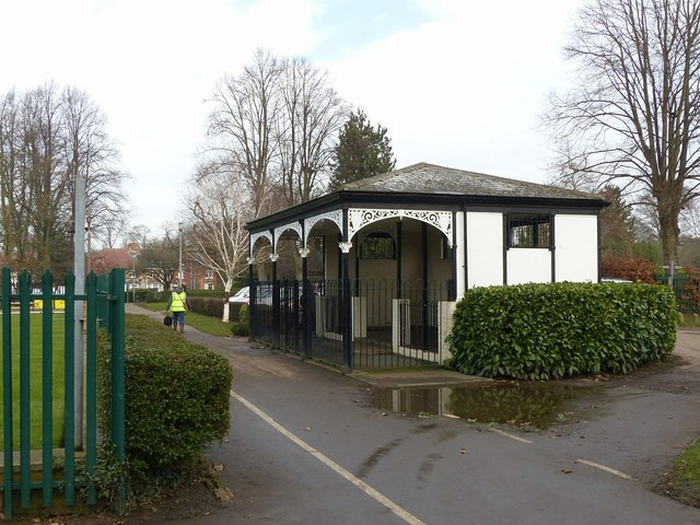
The park as it appears today is the result of a donation of £1000 in 1920 by the Dowager Lady Leconfield in memory of her son Lt. Hon. William Reginald Wyndham, which the Town Council of Grantham used to develop the existing Slate Mill Park as a general memorial to the dead of the First World War. The Council agreed to change the name of the park in recognition of this.
Facilities developed included a swimming pool (based on a long-standing bathing area in the River Witham), a paddling pool, bowling greens and a large shelter with cast iron canopy.
Although application has been made to have the Park listed, this has been declined on the basis that the park represents a development of a previous park and that the facilities do not present a cohesive stylistic grouping and are not of significant architectural interest.
Details of the park and the listing decision here
Link
Link
Link
 Map © Crown Copyright")
- Grid Square
- SK9136, 492 images (more nearby 🔍)
- Photographer
- Alan Murray-Rust (more nearby)
- Date Taken
- Wednesday, 15 February, 2017 (more nearby)
- Submitted
- Friday, 17 February, 2017
- Subject Location
-
OSGB36:
 SK 9173 3644 [10m precision]
WGS84: 52:55.0535N 0:38.2317W - Camera Location
-
OSGB36: SK 9173 3642
- View Direction
- NORTH (about 0 degrees)