2017
SO4520 : Skenfrith Castle, Monmouthshire
taken 7 years ago, near to Skenfrith, Monmouthshire/Sir Fynwy, Wales
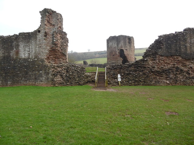
Skenfrith Castle, Monmouthshire
Situated in Skenfrith village, this castle was built in Norman times as a defence against the Welsh. It has a 13th century curtain wall with circular towers at intervals, and a round keep rising from the centre of the enclosed courtyard. A keep stands on top of a mound, suggesting that Skenfrith was built on the site of an earlier motte and bailey castle. It was given by the Skenfrith trustees to The National Trust in 1936 and is now in the guardianship of Cadw- Welsh Government's historic environment service. It is open all the year round and for SatNav purposes, its postcode is NP7 8UH.
 Map © Crown Copyright")
TIP: Click the map for more Large scale mapping
- Grid Square
- SO4520, 529 images (more nearby 🔍)
- Photographer
- David Hillas (more nearby)
- Date Taken
- Friday, 10 February, 2017 (more nearby)
- Submitted
- Sunday, 19 February, 2017
- Subject Location
-
OSGB36:
 SO 4569 2028 [10m precision]
WGS84: 51:52.7057N 2:47.4217W - Camera Location
-
OSGB36: SO 4567 2030
- View Direction
- Southeast (about 135 degrees)