2007
NO5000 : The Beach below Ardross Farm
taken 17 years ago, near to Elie, Fife, Scotland
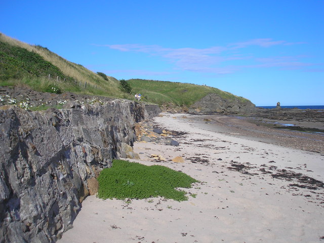
The Beach below Ardross Farm
The view of the beach below Ardross Farm. The Fife Coastal Path goes along the top of the sea wall and then climbs up (from left to right) the headland in the distance. To the right of the headland is an unusual rock formation NO5100 : Rock formation by Ardross
 Map © Crown Copyright")
TIP: Click the map for more Large scale mapping
- Grid Square
- NO5000, 114 images (more nearby 🔍)
- Photographer
- Sandy Gemmill (more nearby)
- Date Taken
- Wednesday, 8 August, 2007 (more nearby)
- Submitted
- Saturday, 18 August, 2007
- Subject Location
-
OSGB36:
 NO 509 007 [100m precision]
WGS84: 56:11.7819N 2:47.5714W - Camera Location
-
OSGB36: NO 509 007
- View Direction
- East-northeast (about 67 degrees)