2017
TR3140 : Closure of Esplanade
taken 7 years ago, near to Dover, Kent, England
This is 1 of 6 images, with title Closure of Esplanade in this square
Closure of Esplanade
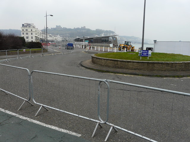
I assume the closure of this road relates to the planning permission that has been granted by Dover District Council, under application number DOV/16/01305, for the modification of legal agreement (under S.106 of the Town and Country Planning Act 1990) to planning permission DOV/98/00334, to allow for the removal of 20 off-street residents parking spaces (to facilitate (a) navigational cut between Dover Harbour and Wellington Dock under the Dover Western Docks Revival Scheme). The application seems to indicate that this road will be bisected by a channel between the dock and the harbour. This shows the TR3140 : Closure of Esplanade from the other direction.
 Map © Crown Copyright")
TIP: Click the map for more Large scale mapping
- Grid Square
- TR3140, 785 images (more nearby 🔍)
- Photographer
- John Baker (more nearby)
- Date Taken
- Friday, 10 February, 2017 (more nearby)
- Submitted
- Thursday, 23 February, 2017
- Subject Location
-
OSGB36:
 TR 3193 4085 [10m precision]
WGS84: 51:7.1979N 1:18.7647E - Camera Location
-
OSGB36: TR 3190 4080
- View Direction
- Northeast (about 45 degrees)