2017
SS8178 : Information board outside St David's Church, Nottage
taken 7 years ago, near to Nottage, Bridgend/Pen-y-Bont ar Ogwr, Wales
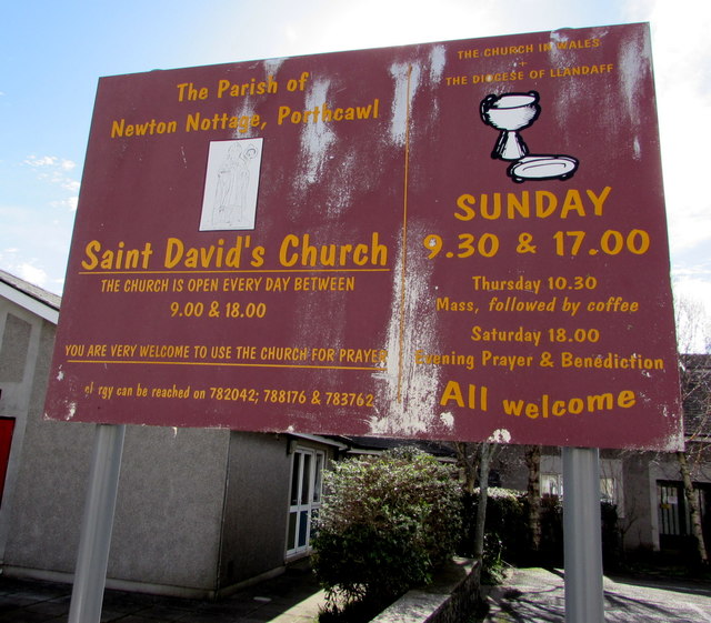
Information board outside St David's Church, Nottage
Facing Florence Street on the north side of this Link church.
 Map © Crown Copyright")
TIP: Click the map for more Large scale mapping
- Grid Square
- SS8178, 140 images (more nearby 🔍)
- Photographer
- Jaggery (more nearby)
- Date Taken
- Saturday, 4 March, 2017 (more nearby)
- Submitted
- Saturday, 4 March, 2017
- Subject Location
-
OSGB36:
 SS 8177 7822 [10m precision]
WGS84: 51:29.4316N 3:42.2601W - Camera Location
-
OSGB36: SS 8177 7822
- View Direction
- SOUTH (about 180 degrees)