2017
SX9192 : Probable flood height mark under railway bridge
taken 7 years ago, near to Exeter, Devon, England
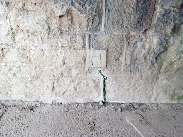
Probable flood height mark under railway bridge
This mark in the concrete under the railway bridge between Exwick Playing Fields and Flowerpot Playing Fields shows "7/3/61" and is most probably the height of flood water on that date. Exeter was severely affected by floods at the end of 1960.
 Map © Crown Copyright")
TIP: Click the map for more Large scale mapping
- Grid Square
- SX9192, 1542 images (more nearby 🔍)
- Photographer
- Brian Henley (more nearby)
- Date Taken
- Saturday, 25 February, 2017 (more nearby)
- Submitted
- Friday, 10 March, 2017
- Subject Location
-
OSGB36:
 SX 9110 9265 [10m precision]
WGS84: 50:43.3942N 3:32.6490W - Camera Location
-
OSGB36: SX 9110 9265
- View Direction
- North-northeast (about 22 degrees)