2017
NS4274 : The Crags Circular Path at Milton
taken 7 years ago, near to Milton, West Dunbartonshire, Scotland
This is 1 of 3 images, with title The Crags Circular Path at Milton in this square
The Crags Circular Path at Milton
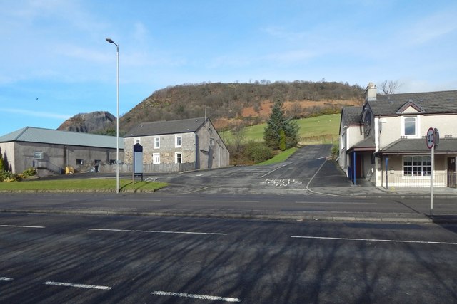
The path shown branching off to the right from the NS4274 : Cycle path at Milton leads to the point, beside the A82, from which this picture was taken. That path and its continuation on the other side of the road are part of a route called the Crags Circular Path.
On the other side of the road, the route follows the short section of road that leads uphill, and then turns to the right (as shown in NS4274 : Path to Milton Brae), continuing as a signposted path, mostly through woodland, to emerge on Milton Brae. For the other end of the path, see NS4274 : Path from Milton Brae.
On the other side of the road, the route follows the short section of road that leads uphill, and then turns to the right (as shown in NS4274 : Path to Milton Brae), continuing as a signposted path, mostly through woodland, to emerge on Milton Brae. For the other end of the path, see NS4274 : Path from Milton Brae.
 Map © Crown Copyright")
TIP: Click the map for more Large scale mapping
- Grid Square
- NS4274, 129 images (more nearby 🔍)
- Photographer
- Lairich Rig (more nearby)
- Date Taken
- Wednesday, 1 March, 2017 (more nearby)
- Submitted
- Saturday, 11 March, 2017
- Subject Location
-
OSGB36:
 NS 4235 7426 [10m precision]
WGS84: 55:56.1281N 4:31.5209W - Camera Location
-
OSGB36: NS 4236 7422
- View Direction
- North-northwest (about 337 degrees)