2007
NX6385 : Southern Upland Way, near Barlaes
taken 17 years ago, 3 km from Earlstoun, Dumfries And Galloway, Scotland
This is 1 of 12 images, with title starting with Southern Upland in this square
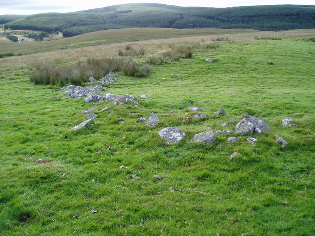
Southern Upland Way, near Barlaes.
Picture taken from a knoll just off the SUW. Carseglass Hill covered in trees forms the background, whilst the old school ruins are just visible on the left. Ordnance Survey use the spelling Carseglass not Corseglass.
 Map © Crown Copyright")
TIP: Click the map for more Large scale mapping
- Grid Square
- NX6385, 26 images (more nearby 🔍)
- Photographer
- Bob Peace (more nearby)
- Date Taken
- Tuesday, 21 August, 2007 (more nearby)
- Submitted
- Tuesday, 21 August, 2007
- Subject Location
-
OSGB36:
 NX 637 857 [100m precision]
WGS84: 55:8.8316N 4:8.3755W - Camera Location
-
OSGB36: NX 635 858
- View Direction
- East-southeast (about 112 degrees)