2017
J3281 : Advance direction sign, M2 hill section, Belfast (March 2017)
taken 7 years ago, near to Carnmoney, Co Antrim, Northern Ireland
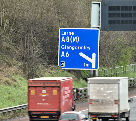
Advance direction sign, M2 hill section, Belfast (March 2017)
Advance direction sign, for the Sandyknowes turnoff J3082 : Sandyknowes roundabout near Belfast (1), beside the outward lanes of the M2, seen from the Bellevue Bridge on the Antrim Road.
Road signs and markings, Northern Ireland
A collection of photographs showing road signs and marking in their context. It exists as a matter of record only, has no connection with any official body and does not claim to be a definitive or legally-binding guide. The official version is the Highway Code for Northern Ireland.
No breach of Crown copyright intended. I believe that my submissions are in accordance with the terms of the Open Government Licence for public sector information Link
Loading map... (JavaScript required)
- Grid Square
- J3281, 21 images (more nearby 🔍)
- Photographer
- Albert Bridge (more nearby)
- Date Taken
- Thursday, 23 March, 2017 (more nearby)
- Submitted
- Thursday, 23 March, 2017
- Subject Location
-
Irish:
 J 322 815 [100m precision]
WGS84: 54:39.8989N 5:57.0860W - Camera Location
-
Irish: J 324 814
- View Direction
- West-northwest (about 292 degrees)