TR3241 : Dover Castle: St Mary in Castro church and the Roman lighthouse
taken 7 years ago, near to Dover, Kent, England
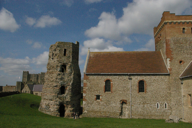
Behind the lighthouse is the castle keep.
One of the largest castles in the country, strategically located at the shortest crossing point to continental Europe, Dover Castle has played a prominent part in national history. Its origins lie in the Iron Age, and a Roman Lighthouse and Anglo-Saxon church can still be seen within the grounds.
William of Normandy strengthened existing Anglo-Saxon fortifications here in 1066, but it was Henry II who set the blueprint for today's castle when he had the fortifications rebuilt in the 1180's, adding the massive keep and a series of concentric defences. Over the centuries, the defences were continually enlarged and improved, with the castle retaining a military role into the mid twentieth century. An underground hospital and the command centre used for the Dunkirk evacuation are a legacy from the Second World War.
[Excerpt from Castle Explorer Link]
 Map © Crown Copyright")
- Grid Square
- TR3241, 1329 images (more nearby 🔍)
- Photographer
- Christopher Hilton (more nearby)
- Date Taken
- Wednesday, 5 April, 2017 (more nearby)
- Submitted
- Thursday, 6 April, 2017
- Subject Location
-
OSGB36:
 TR 3260 4181 [10m precision]
WGS84: 51:7.6987N 1:19.3752E - Camera Location
-
OSGB36: TR 3261 4179
- View Direction
- North-northwest (about 337 degrees)