2017
TQ4628 : Path up to Camp Hill
taken 7 years ago, near to Fairwarp, East Sussex, England
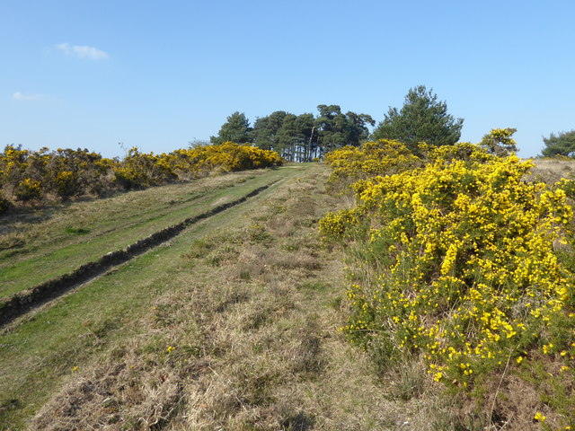
Path up to Camp Hill
Ashdown Forest is a former medieval hunting forest, and is the highest ridge of the High Weald. At ten square miles it is the largest open access area in the South East. Ashdown Forest was purchased by East Sussex County Council from the De La Warr family in 1988. It is now managed by a Board of Conservators. Nearly two thirds of it is heathland. One of the characteristics of the forest are these isolated clumps of trees, often on hill tops. Camp Hill Clump on the skyline here was first planted in 1825. Its name probably derives from a military camp nearby.
Much of Ashdown Forest was a blaze of yellow from the gorse in early April.
Much of Ashdown Forest was a blaze of yellow from the gorse in early April.
 Map © Crown Copyright")
TIP: Click the map for more Large scale mapping
- Grid Square
- TQ4628, 154 images (more nearby 🔍)
- Photographer
- Marathon (more nearby)
- Date Taken
- Friday, 7 April, 2017 (more nearby)
- Submitted
- Sunday, 9 April, 2017
- Subject Location
-
OSGB36:
 TQ 4692 2894 [10m precision]
WGS84: 51:2.4622N 0:5.6576E - Camera Location
-
OSGB36: TQ 4691 2881
- View Direction
- NORTH (about 0 degrees)