2017
SX7574 : Parish boundary, Halshanger Common
taken 7 years ago, 3 km from Haytor Vale, Devon, England
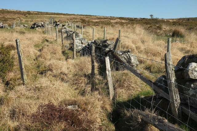
Parish boundary, Halshanger Common
They take their parish boundaries pretty seriously on the moor, if this is anything to go by. In the centre is a broken-down wall which runs fairly straight across the slopes of Rippon Tor. On either side are stout fences with barbed wire. The parishes involved are Ashburton (this side) and Ilsington.
 Map © Crown Copyright")
TIP: Click the map for more Large scale mapping
- Grid Square
- SX7574, 28 images (more nearby 🔍)
- Photographer
- Derek Harper (more nearby)
- Date Taken
- Friday, 7 April, 2017 (more nearby)
- Submitted
- Monday, 10 April, 2017
- Subject Location
-
OSGB36:
 SX 7510 7478 [10m precision]
WGS84: 50:33.5634N 3:45.8812W - Camera Location
-
OSGB36: SX 7510 7477
- View Direction
- NORTH (about 0 degrees)