2007
TR1054 : Chartham Paper Mills
taken 17 years ago, near to Chartham, Kent, England
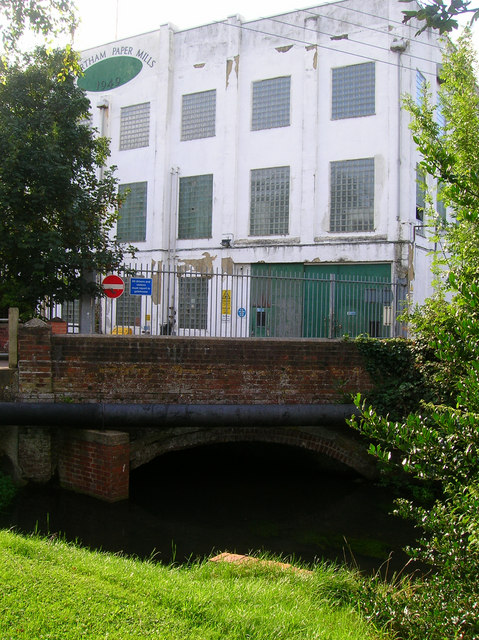
Chartham Paper Mills
Five mills were working on this site when the Domesday Book was written and milling in one form or another has continued ever since; a fulling mill was known to exist in 1438 whilst paper milling began around 1730. The watercourses were diverted into their present routes in 1857 and by the end of the 19th century the mill had a reputation for producing the best paper in the country. An accident involving too much vegetable starch added to the paper mixture produced a more translucent paper ideal for tracing. The mill has been specialising in the same type of paper ever since. The bridge carries Rattington Street over the southernmost mill leat which runs next to Stour Road where the image was taken.
 Map © Crown Copyright")
TIP: Click the map for more Large scale mapping
- Grid Square
- TR1054, 114 images (more nearby 🔍)
- Photographer
- Simon Carey (more nearby)
- Date Taken
- Friday, 24 August, 2007 (more nearby)
- Submitted
- Saturday, 25 August, 2007
- Subject Location
-
OSGB36:
 TR 108 549 [100m precision]
WGS84: 51:15.2834N 1:1.1988E - Camera Location
-
OSGB36: TR 108 549
- View Direction
- West-northwest (about 292 degrees)