Geograph - photograph every grid square
2005
SP6737
: Stowe School
taken
19 years ago
,
near
to
Dadford
, Buckinghamshire, England
This is 1 of
6 images, with title Stowe School
in this square
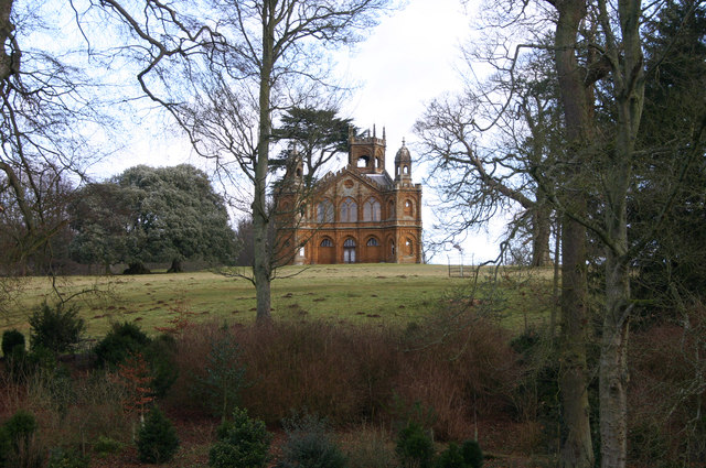
Stowe School
This is one of many interesting buildings in the grounds of Stowe School.
© Copyright
Malcolm Neal
and licensed for
reuse
under this
Creative Commons Licence
.
Licensing
Download
More Sizes
Share...
Share this photo via Twitter
Share this photo via Facebook
Share this photo via Pinterest
Share this photo via Flipboard
Share this photo via email/e-card
Grab a Stamped/Watermarked Image
Mark
👍🏻
Like Image
👍🏻
Like Description
Update Information
Contact Contributor
Geographical Context:
Historic sites and artefacts
Village, Rural settlement
Educational sites
other tags:
Temple
Historic
Click a tag, to view other nearby images.
This photo is linked from:
Automatic Clusters
: ·
Stowe School [47]
·
Buildings at Stowe [23]
Title Clusters
: ·
Stowe School [6]
·
TIP: Click the map for more Large scale mapping
Grid Square
SP6737
, 285 images (
more nearby
🔍
)
Photographer
Malcolm Neal
(
more nearby
)
Date Taken
Sunday, 2 January, 2005 (
more nearby
)
Submitted
Monday, 17 April, 2017
Subject Location
OSGB36:
SP 6772 3768
[10m precision]
WGS84:
52:2.0041N
1:0.8549W
Camera Location
OSGB36:
SP 6775 3745
View Direction
NORTH (about 0 degrees)
NW
N
NE
W
Go
E
SW
S
SE
View Discussion for SP6737
View this location on ...
Geograph Coverage Map (includes OSM etc)
Geograph Links Page
Open in Google Maps
Navigate to location with Google Maps
Open in Google Earth Pro
Open in Google Earth for Web
Open in Bing Maps
Navigate with Google Maps
Lookup nearest Postcode
Image Type
(about)
:
geograph
This page has been
viewed
about
19
times
☰
Home
View
Search
Marked Images
Maps
Browser
Explore
Showcase
New Images
Collections
Interact
Games
Discussions
Blog
Contributors
Submit
Statistics
Leaderboards
General
FAQ
Help Pages
Sitemap
Contact Us
Support Us
sponsored by
Discussion on SP6737
SP6737 : The Gothic Temple, Stowe Park
An early Gothic revival building, built to a triangular plan and begun before 1744AD.
🔍
What to search:
Photos
Enter keywords or a location/postcode to search nearby images
Photos near SP6737
Enter a Grid Reference
Placenames
Collections
Website Pages
Everything
Others:
Advanced Search
|
Image Browser
Or:
Coverage Map
|
Searchable Map
You are not logged in
login
|
register