2016
NZ1843 : Clifford's House Farm, Quebec
taken 7 years ago, near to Quebec, County Durham, England
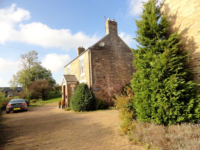
Clifford's House Farm, Quebec
This farm is to the south of the present village, which wasn't built until the late C19. In contrast, the farm here is shown on the 1861 Ordnance Survey map, and is probably early C19 in date. However, this was not the original farmhouse and doesn't appear until the 1923 O S map.
 Map © Crown Copyright")
TIP: Click the map for more Large scale mapping
- Grid Square
- NZ1843, 32 images (more nearby 🔍)
- Photographer
- Robert Graham (more nearby)
- Date Taken
- Tuesday, 25 October, 2016 (more nearby)
- Submitted
- Wednesday, 19 April, 2017
- Subject Location
-
OSGB36:
 NZ 1804 4352 [10m precision]
WGS84: 54:47.1755N 1:43.2604W - Camera Location
-
OSGB36: NZ 1807 4349
- View Direction
- Northwest (about 315 degrees)