NS3274 : Lidl, Port Glasgow
taken 10 years ago, near to Port Glasgow, Inverclyde, Scotland
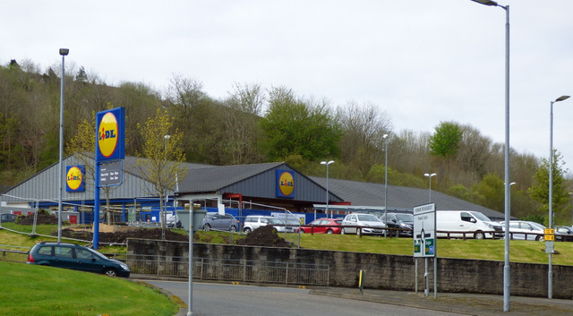
See the same scene before the Bouverie Street tenements were demolished in 2014 NS3274 : Lidl and Bouverie.
Bouverie Street (known locally as simply Bouverie and pronounced "Boovri") is a row of former mill workers' flats on a steep slope behind the former Gourock Ropeworks mill building NS3274 : Flash back in time & NS3274 : PS Comet passing former Gourock Ropeworks mill.
The street was built in the late 19th Century. Contrary to local popular belief, there were never tenements for the full length of both sides of the street, as can be seen in the 1932 aerial photos on the Canmore web site Link.
At the time of writing (2012), the tenements are due for demolition; apparently it is financially viable to bring them up to modern living standards, but the cost of improving the steeply sloping grounds to the rear for human use (gardens, drying areas etc) is prohibitive.
In other places, the money might be available to preserve them as they are historically significant, but unfortunately this is not the case in Inverclyde, which has the fastest declining population in Scotland.
At around 210 metres, the building has been described locally as the longest tenement in Europe (this is incorrect as there are longer blocks in paisley and Glasgow). The views of the River Clyde and the Highlands from the flats are spectacular.
2015 update: Demolition of the street was completed in 2014.


- Grid Square
- NS3274, 1845 images (more nearby 🔍)
- Photographer
- Thomas Nugent (more nearby)
- Date Taken
- Monday, 17 April, 2017 (more nearby)
- Submitted
- Friday, 21 April, 2017
- Subject Location
-
OSGB36:
 NS 3267 7432
[10m precision]
WGS84: 55:55.9641N 4:40.8099W - Camera Location
-
OSGB36:
NS 3277 7434
- View Direction
- West-southwest (about 247 degrees)


