2017
TM2117 : Holland Brook
taken 7 years ago, near to Holland-on-Sea, Essex, England
Holland Brook
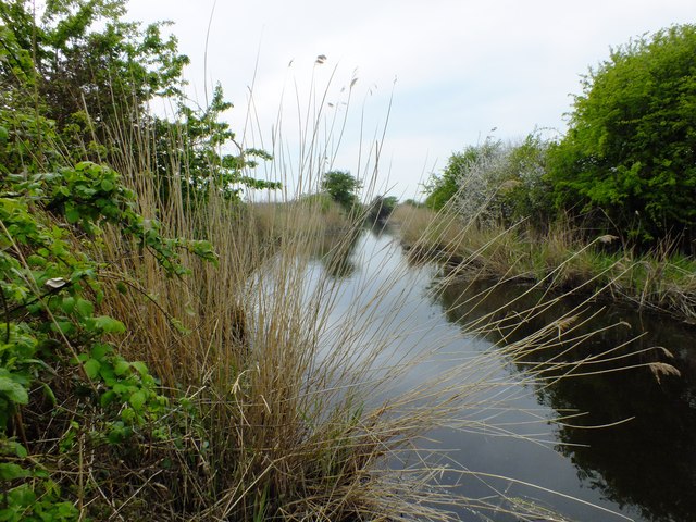
Holland Brook at Holland Haven, looking west towards Great Holland.
Seeing Holland Brook as it is now, it is hard to believe that this and the nearby waterway, Pickers Ditch which runs behind Holland on Sea, and is branch off the Brook, was in fact a small port in Tudor times.
Seeing Holland Brook as it is now, it is hard to believe that this and the nearby waterway, Pickers Ditch which runs behind Holland on Sea, and is branch off the Brook, was in fact a small port in Tudor times.
 Map © Crown Copyright")
TIP: Click the map for more Large scale mapping
- Grid Square
- TM2117, 24 images (more nearby 🔍)
- Photographer
- Peter Pearson (more nearby)
- Date Taken
- Thursday, 20 April, 2017 (more nearby)
- Submitted
- Saturday, 22 April, 2017
- Subject Location
-
OSGB36:
 TM 215 172 [100m precision]
WGS84: 51:48.5927N 1:12.7248E - Camera Location
-
OSGB36: TM 216 172
- View Direction
- West-southwest (about 247 degrees)