2017
NY9863 : Road closure near Corbridge
taken 7 years ago, near to Corbridge, Northumberland, England
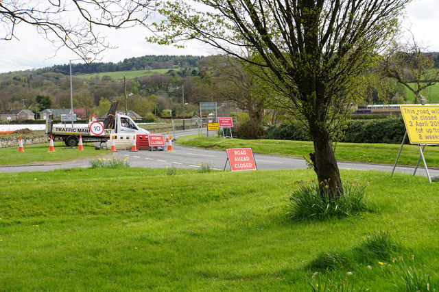
Road closure near Corbridge
The work includes digging a hole, followed by resurfacing. It means that you currently cannot drive to Corbridge Station.
 Map © Crown Copyright")
TIP: Click the map for more Large scale mapping
- Grid Square
- NY9863, 97 images (more nearby 🔍)
- Photographer
- Bill Boaden (more nearby)
- Date Taken
- Tuesday, 18 April, 2017 (more nearby)
- Submitted
- Monday, 24 April, 2017
- Subject Location
-
OSGB36:
 NY 9887 6394 [10m precision]
WGS84: 54:58.2047N 2:1.1510W - Camera Location
-
OSGB36: NY 9885 6399
- View Direction
- South-southeast (about 157 degrees)