2017
NT5173 : Weir on the River Tyne
taken 7 years ago, near to Haddington, East Lothian, Scotland
This is 1 of 3 images, with title starting with Weir on the River Tyne in this square
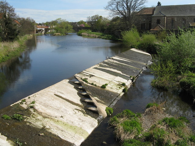
Weir on the River Tyne
Looking upstream from Victoria Bridge towards Nungate Bridge. I have never seen one like it before, but I assume the 'steps' are a fish ladder.
 Map © Crown Copyright")
TIP: Click the map for more Large scale mapping
- Grid Square
- NT5173, 534 images (more nearby 🔍)
- Photographer
- M J Richardson (more nearby)
- Date Taken
- Sunday, 23 April, 2017 (more nearby)
- Submitted
- Tuesday, 25 April, 2017
- Subject Location
-
OSGB36:
 NT 5180 7393 [10m precision]
WGS84: 55:57.3578N 2:46.4112W - Camera Location
-
OSGB36: NT 5179 7395
- View Direction
- South-southeast (about 157 degrees)