2017
SK5029 : Foot and cycle path beside the A453
taken 7 years ago, near to Ratcliffe on Soar, Nottinghamshire, England
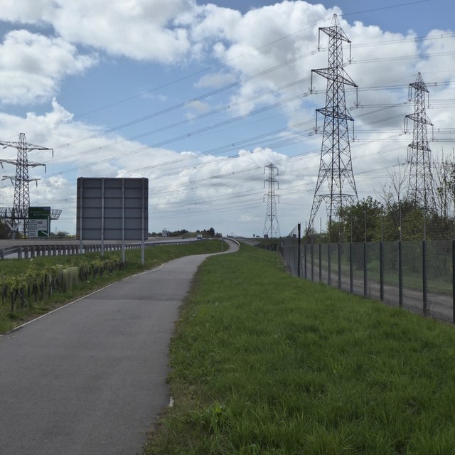
Foot and cycle path beside the A453
The security fence on the right surrounds Ratcliffe on Soar power station and the power lines, naturally, are one of the feeds out to the national grid.
 Map © Crown Copyright")
TIP: Click the map for more Large scale mapping
- Grid Square
- SK5029, 33 images (more nearby 🔍)
- Photographer
- David Lally (more nearby)
- Date Taken
- Wednesday, 26 April, 2017 (more nearby)
- Submitted
- Wednesday, 26 April, 2017
- Subject Location
-
OSGB36:
 SK 5020 2945 [10m precision]
WGS84: 52:51.6123N 1:15.3507W - Camera Location
-
OSGB36: SK 50293 29504
- View Direction
- West-southwest (about 247 degrees)