2017
TA0322 : Queen Street, Barton-upon-Humber, Lincolnshire
taken 7 years ago, near to Barton-Upon-Humber, North Lincolnshire, England
This is 1 of 12 images, with title Queen Street, Barton-upon-Humber, Lincolnshire in this square
Queen Street, Barton-upon-Humber, Lincolnshire
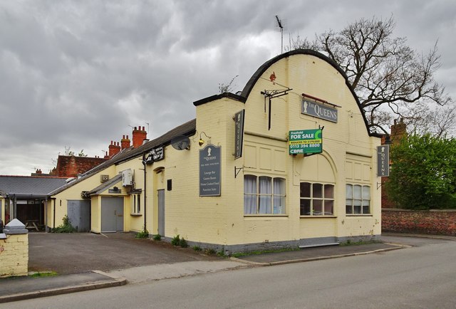
At the junction with Newport Street, The Queens, formerly the New Queens Club, Queen Street. Originally opened as the Liberal Club in 1911 (another source states 1893), now closed.
Ten foundation stones are set into the north and east elevations, all but two of which are now illegible. They read: 'This stone was laid by the president of the Barton Liberal Association' and 'This stone was laid by Mrs. Brummitt for the Womens Liberal Assosiation [sic].'
Ten foundation stones are set into the north and east elevations, all but two of which are now illegible. They read: 'This stone was laid by the president of the Barton Liberal Association' and 'This stone was laid by Mrs. Brummitt for the Womens Liberal Assosiation [sic].'
 Map © Crown Copyright")
TIP: Click the map for more Large scale mapping
- Grid Square
- TA0322, 543 images (more nearby 🔍)
- Photographer
- Bernard Sharp (more nearby)
- Date Taken
- Thursday, 20 April, 2017 (more nearby)
- Submitted
- Thursday, 27 April, 2017
- Subject Location
-
OSGB36:
 TA 0315 2224 [10m precision]
WGS84: 53:41.1864N 0:26.3736W - Camera Location
-
OSGB36: TA 0317 2222
- View Direction
- Northwest (about 315 degrees)