2007
SD6399 : Carlin Gill
taken 17 years ago, 3 km from Lowgill, Cumbria, England
This is 1 of 4 images, with title Carlin Gill in this square
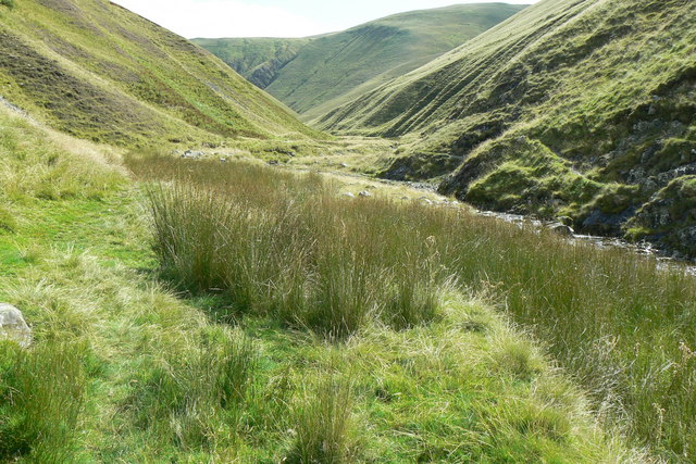
Carlin Gill
The far horizon shows Ulgill Rigg on the left with Blake Ridge on the right, with the cliffs of Black Force just visible between and below them.
 Map © Crown Copyright")
TIP: Click the map for more Large scale mapping
- Grid Square
- SD6399, 14 images (more nearby 🔍)
- Photographer
- Donald Cruttenden (more nearby)
- Date Taken
- Sunday, 26 August, 2007 (more nearby)
- Submitted
- Monday, 27 August, 2007
- Subject Location
-
OSGB36:
 SD 633 994 [100m precision]
WGS84: 54:23.3576N 2:33.9811W - Camera Location
-
OSGB36: SD 631 995
- View Direction
- East-southeast (about 112 degrees)