2017
TQ1568 : Thames Path, East Molesey
taken 7 years ago, near to East Molesey, Surrey, England
Thames Path, East Molesey
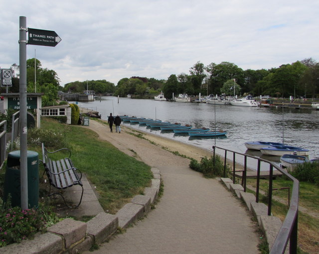
Facing the A3050 Riverbank, the Thames Path sign on
the south bank of the Thames shows Walton on Thames 4½ m(iles).
the south bank of the Thames shows Walton on Thames 4½ m(iles).
Thames Path
This National Trail is 184 miles (294 km) long, following the River Thames from its source in the Cotswolds almost to the sea, finishing at the Thames Barrier in Greenwich.
The trail keeps to the banks of the river most of the route.
Website: Link
 Map © Crown Copyright")
TIP: Click the map for more Large scale mapping
- Grid Square
- TQ1568, 1222 images (more nearby 🔍)
- Photographer
- Jaggery (more nearby)
- Date Taken
- Saturday, 29 April, 2017 (more nearby)
- Submitted
- Thursday, 4 May, 2017
- Subject Location
-
OSGB36:
 TQ 1529 6847 [10m precision]
WGS84: 51:24.2131N 0:20.6369W - Camera Location
-
OSGB36: TQ 1530 6846
- View Direction
- Northwest (about 315 degrees)