2017
SU9082 : Boulters Lock, Maidenhead
taken 7 years ago, near to Taplow, Buckinghamshire, England
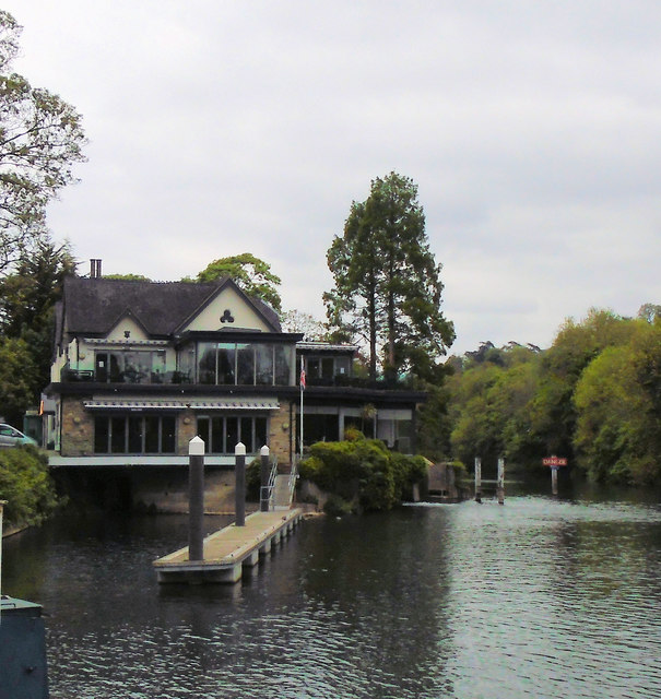
Boulters Lock, Maidenhead
Boulter's Lock is a lock and weir on the River Thames on the eastern side of Maidenhead. A lock was first built here by the Thames Navigation Commission in 1772. The lock is on the western side of the river between the main (A4094) Maidenhead to Cookham road and Ray Mill Island. The name is also used for the immediate surrounding area.
The weir is some way upstream of the lock, at the northern end of Ray Mill Island.
Wikipedia: Link
See other images of Boulter's Lock
The weir is some way upstream of the lock, at the northern end of Ray Mill Island.
Wikipedia: Link
See other images of Boulter's Lock
 Map © Crown Copyright")
TIP: Click the map for more Large scale mapping
- Grid Square
- SU9082, 133 images (more nearby 🔍)
- Photographer
- Paul Gillett (more nearby)
- Date Taken
- Thursday, 4 May, 2017 (more nearby)
- Submitted
- Saturday, 6 May, 2017
- Subject Location
-
OSGB36:
 SU 90327 82291 [1m precision]
WGS84: 51:31.9387N 0:41.9509W - Camera Location
-
OSGB36: SU 90333 82244
- View Direction
- NORTH (about 0 degrees)