2017
ST1890 : Track, Twyn yr Oerfel, Mynydd y Grug Common
taken 7 years ago, near to Cwmfelinfach, Caerphilly/Caerffili, Wales
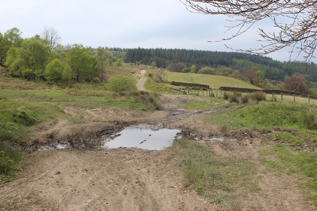
Track, Twyn yr Oerfel, Mynydd y Grug Common
This rough track, a byway, is part of the Rhymney Valley Ridgeway Walk on the edge of the common; the fence on the right is the boundary of the common. The large puddle was almost the only muddy area I encountered on the Walk - unsurprisingly after a dry month. This section of the common is part of the Twyn yr Oerfel Site of Importance for Nature Conservation.
 Map © Crown Copyright")
TIP: Click the map for more Large scale mapping
- Grid Square
- ST1890, 19 images (more nearby 🔍)
- Photographer
- M J Roscoe (more nearby)
- Date Taken
- Saturday, 6 May, 2017 (more nearby)
- Submitted
- Wednesday, 10 May, 2017
- Subject Location
-
OSGB36:
 ST 1844 9067 [10m precision]
WGS84: 51:36.5360N 3:10.7515W - Camera Location
-
OSGB36: ST 1857 9065
- View Direction
- WEST (about 270 degrees)