2017
NS3483 : Cleared forestry land
taken 7 years ago, near to Dumfin, Argyll And Bute, Scotland
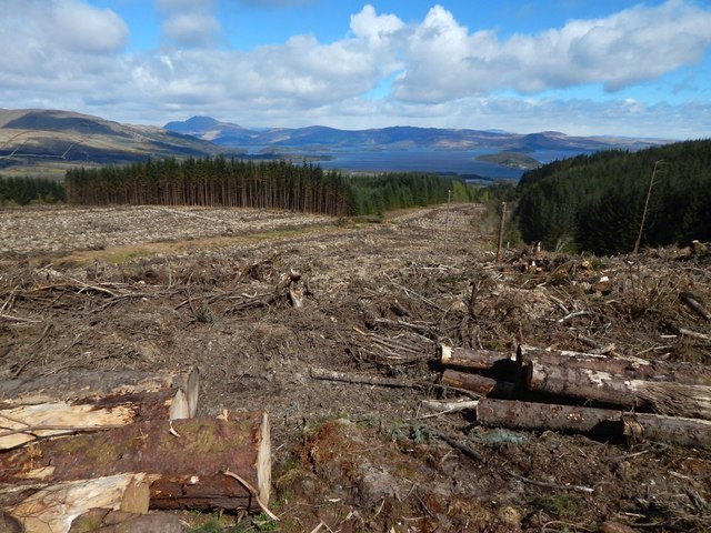
Cleared forestry land
The view is from the NS3483 : Corner of a forestry track. The green lane of a pre-existing clearing can be seen entering at about the midpoint of the left-hand edge of the image, and crossing obliquely to the right.
Beyond Loch Lomond, Ben Lomond can be seen on the left, and Inchmurrin and Conic hill on the right, the last two named being on the line of the Highland Boundary Fault.
Beyond Loch Lomond, Ben Lomond can be seen on the left, and Inchmurrin and Conic hill on the right, the last two named being on the line of the Highland Boundary Fault.
 Map © Crown Copyright")
TIP: Click the map for more Large scale mapping
- Grid Square
- NS3483, 35 images (more nearby 🔍)
- Photographer
- Lairich Rig (more nearby)
- Date Taken
- Monday, 24 April, 2017 (more nearby)
- Submitted
- Saturday, 20 May, 2017
- Subject Location
-
OSGB36:
 NS 3465 8342 [10m precision]
WGS84: 56:0.9056N 4:39.2459W - Camera Location
-
OSGB36: NS 3452 8319
- View Direction
- North-northeast (about 22 degrees)