2017
NY8383 : Ordnance Survey cut benchmark
taken 7 years ago, near to Bellingham, Northumberland, England
This is 1 of 3 images, with title Ordnance Survey cut benchmark in this square
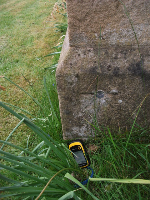
Ordnance Survey cut benchmark
An Ordnance Survey cut benchmark used to indicate height above sea level - 115.3
 Map © Crown Copyright")
TIP: Click the map for more Large scale mapping
- Grid Square
- NY8383, 189 images (more nearby 🔍)
- Photographer
- Michael Rye (more nearby)
- Date Taken
- Sunday, 21 May, 2017 (more nearby)
- Submitted
- Tuesday, 23 May, 2017
- Subject Location
-
OSGB36:
 NY 8338 8337 [10m precision]
WGS84: 55:8.6638N 2:15.7371W - Camera Location
-
OSGB36: NY 8338 8337
- View Direction
- SOUTH (about 180 degrees)