2017

SX8558 : Broadley Lane #6

taken 7 years ago, near to Stoke Gabriel, Devon, England
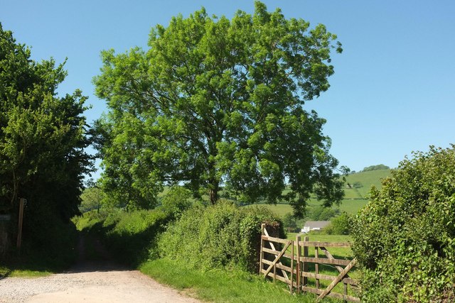
Broadley Lane #6
Broadley Lane #6
The end of the public motorable road; Broadley Lane continues as a route with public access along a green lane to Coombe House Lane. A fine ash tree in the centre.

Creative Commons Licence [Some Rights Reserved]   © Copyright Derek Harper and licensed for reuse under this Creative Commons Licence.
Geographical Context: Lowlands Roads, Road transport Gates: Timber other tags: Lane Route with Public Access Green Lane Roadside Hedge Trees Ash Tree Click a tag, to view other nearby images.
This photo is linked from: Automatic Clusters: · Public Access Route [7] · Tree [7] · Ash Tree [4] · Green Lane to Coombe House Lane [4] · Continues as a Green Lane [3] Other Photos: · Small wood near Broadley ·
1:50,000 Modern Day Landranger(TM) Map © Crown Copyright
+
+
1:50,000 Modern Day Landranger(TM) Map © Crown Copyright
TIP: Click the map for more Large scale mapping
Grid Square
SX8558, 80 images   (more nearby 🔍)
Photographer
Derek Harper   (more nearby)
Date Taken
Thursday, 25 May, 2017   (more nearby)
Submitted
Sunday, 28 May, 2017
Subject Location
OSGB36: geotagged! SX 8526 5839 [10m precision]
WGS84: 50:24.8483N 3:36.9766W
Camera Location
OSGB36: geotagged! SX 8526 5837
View Direction
North-northwest (about 337 degrees)
Clickable map
+
NW N NE
W Go E
SW S SE
Image Type (about): geograph 
This page has been viewed about 15 times
You are not logged in login | register