1991
SP2056 : Clopton Tower and converted farm buildings
taken 32 years ago, near to Stratford-Upon-Avon, Warwickshire, England
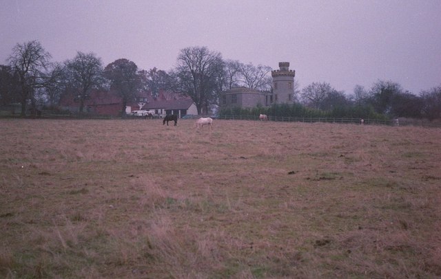
Clopton Tower and converted farm buildings
Clopton Tower was built as a belvedere tower for the Clopton estate in the early 1850s and converted with an extension in the 1970s. The tower is Grade II listed. Link The buildings to the left are converted farm buildings used by an uncle of mine in the 1950s and 1960s. For a similar view twenty years later see: SP2056 : Converted farm buildings, Clopton estate. Apologies for the poor quality of this picture taken on a dull grey November afternoon. Taken on a 1948 Leica IIIC with an Elmar 5cm lens.
 Map © Crown Copyright")
TIP: Click the map for more Large scale mapping
- Grid Square
- SP2056, 64 images (more nearby 🔍)
- Photographer
- Philip Halling (more nearby)
- Date Taken
- Thursday, 28 November, 1991 (more nearby)
- Submitted
- Sunday, 11 June, 2017
- Subject Location
-
OSGB36:
 SP 2045 5644 [10m precision]
WGS84: 52:12.3486N 1:42.1300W - Camera Location
-
OSGB36: SP 2031 5641
- View Direction
- East-northeast (about 67 degrees)