SJ8598 : New housing at New Islington
taken 7 years ago, near to Manchester, England
The Rochdale Canal runs for 33 miles between Manchester and Sowerby Bridge in West Yorkshire, UK. In Sowerby Bridge it connects with the Calder and Hebble Navigation. In Manchester it connects with the Ashton and Bridgewater Canals.
The canal was opened between Sowerby Bridge and Todmorden and from Manchester to Rochdale in 1799 and between Todmorden and Rochdale in 1805. Most of the canal was closed in 1952. Restoration work began in late 1980s and by 1996 the canal was opened to navigation once again between Sowerby Bridge and the summit level. The canal was re-opened to navigation along its entire length in July 2002 and forms part of the South Pennine Ring.
Link
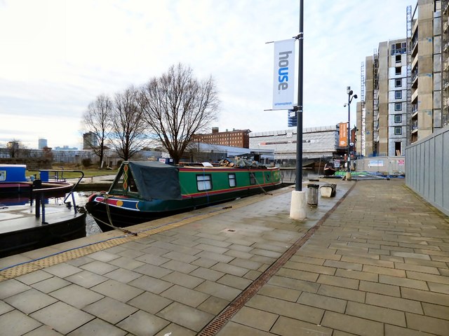
The New Islington Marina is centred on Old Mill Street in an area of Ancoats that has seen considerable urban regeneration since the Millennium. The marina services both the Ashton Canal on one side and the Rochdale Canal on the other, although there is no direct connection between the two canals.
 Map © Crown Copyright")
- Grid Square
- SJ8598, 725 images (more nearby 🔍)
- Photographer
- Gerald England (more nearby)
- Date Taken
- Saturday, 14 January, 2017 (more nearby)
- Submitted
- Sunday, 11 June, 2017
- Subject Location
-
OSGB36:
 SJ 8517 9855 [10m precision]
WGS84: 53:29.0074N 2:13.4967W - Camera Location
-
OSGB36: SJ 8519 9854
- View Direction
- West-northwest (about 292 degrees)