2015

SE2424 : Former Great Northern Railway in Lower Soothill

taken 9 years ago, near to Batley, Kirklees, England
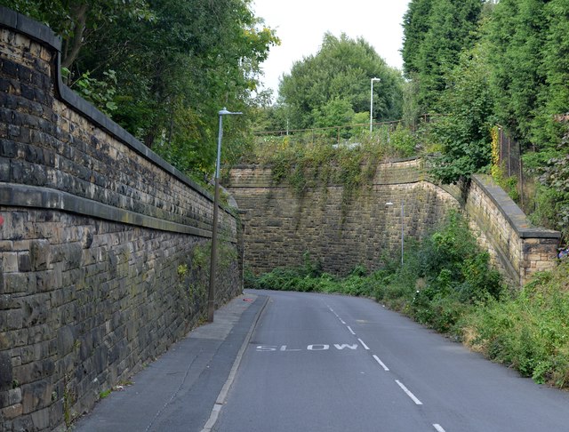
Former Great Northern Railway in Lower Soothill
The canyon like retaining walls and bridge abutments still remain where the Batley to Beeston via Woodkirk Railway crossed Lady Ann Road north of West Street. The route was decommissioned completely in 1953 and few examples of the infrastructure now remain. This is one of them.

Creative Commons Licence [Some Rights Reserved]   © Copyright Bobby Clegg and licensed for reuse under this Creative Commons Licence.
Geographical Context: Suburb, Urban fringe Railways Primary Subject: Bridge
This photo is linked from: Automatic Clusters: · Lady Ann [27] · West [9] ·
1:50,000 Modern Day Landranger(TM) Map © Crown Copyright
+
+
1:50,000 Modern Day Landranger(TM) Map © Crown Copyright
TIP: Click the map for more Large scale mapping
Grid Square
SE2424, 385 images   (more nearby 🔍)
Photographer
Bobby Clegg   (more nearby)
Date Taken
Sunday, 13 September, 2015   (more nearby)
Submitted
Tuesday, 20 June, 2017
Subject Location
OSGB36: geotagged! SE 2497 2419 [10m precision]
WGS84: 53:42.8121N 1:37.3889W
Camera Location
OSGB36: geotagged! SE 2497 2417
View Direction
NORTH (about 0 degrees)
Clickable map
+
NW N NE
W Go E
SW S SE
Image Type (about): geograph 
This page has been viewed about 130 times
You are not logged in login | register