2017
NO2306 : Path to Craigmead car park, Lomond Hills
taken 7 years ago, near to Glasslie, Fife, Scotland
Path to Craigmead car park, Lomond Hills
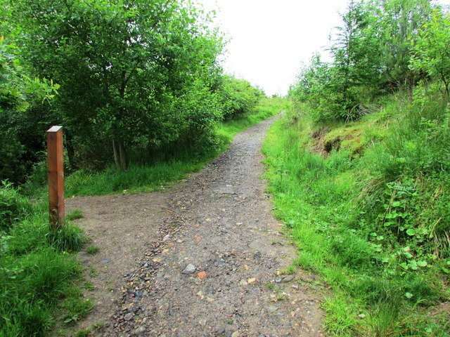
The path from the Yad waterfall at the head of Maspie Den NO2306 : The Yad Waterfall, Maspie Den, Lomond Hills comes in from the left. The path straight ahead runs through the Coalpit Community Woodlands to Craigmead car park. In the opposite direction (behind the camera) it runs downhill to eventually join the lower reaches of the path to Maspie Den.
See Lomond Hills Regional Park article Link
See Lomond Hills Regional Park article Link
 Map © Crown Copyright")
TIP: Click the map for more Large scale mapping
- Grid Square
- NO2306, 60 images (more nearby 🔍)
- Photographer
- Bill Kasman (more nearby)
- Date Taken
- Sunday, 11 June, 2017 (more nearby)
- Submitted
- Tuesday, 27 June, 2017
- Subject Location
-
OSGB36:
 NO 2344 0688 [10m precision]
WGS84: 56:14.8948N 3:14.2247W - Camera Location
-
OSGB36: NO 2348 0689
- View Direction
- West-southwest (about 247 degrees)