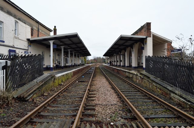
TA0257 : Driffield Station
taken 7 years ago, near to Driffield, East Riding of Yorkshire, England
The Yorkshire Coast Line is a railway line. It runs northwards from Hull Paragon to Bridlington and Scarborough calling at other intermediate stations. The line dates from 1846.
Wikipedia: Link
Driffield station serves the town of Driffield. It is located on the Yorkshire Coast Line and is operated by Northern, providing all passenger train services. The station opened in 1846.
Driffield, also known as Great Driffield, is a market town in the East Riding of Yorkshire. The town is located on Driffield Beck in the northern part of Holderness, 23 miles north of Hull. It is at the head of The Driffield Canal.
Driffield contains a small community hospital, small fire station, police and ambulance stations, several churches - the largest being All Saints' Parish Church.
 Map © Crown Copyright")
- Grid Square
- TA0257, 502 images (more nearby 🔍)
- Photographer
- N Chadwick (more nearby)
- Date Taken
- Sunday, 1 January, 2017 (more nearby)
- Submitted
- Wednesday, 28 June, 2017
- Subject Location
-
OSGB36:
 TA 0269 5728 [10m precision]
WGS84: 54:0.0809N 0:26.0895W - Camera Location
-
OSGB36: TA 0268 5726
- View Direction
- North-northeast (about 22 degrees)