2017
SH2081 : The Anglesey Coastal Path approaching Ellin's Tower
taken 7 years ago, 4 km W of Holyhead/Caergybi, Isle of Anglesey/Sir Ynys Mon, Wales
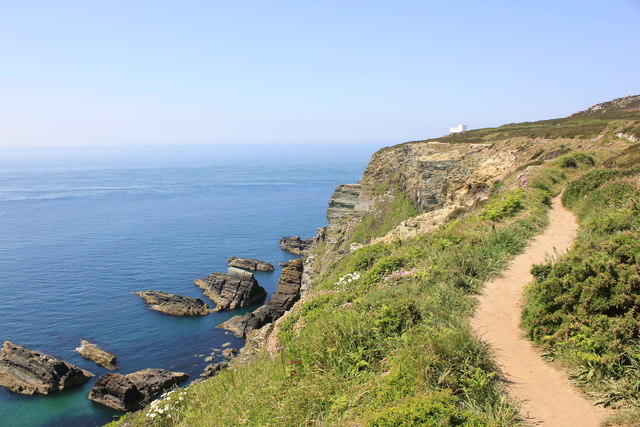
The Anglesey Coastal Path approaching Ellin's Tower
Heading north along the Anglesey Coastal Path towards Ellin's Tower near South Stack.
 Map © Crown Copyright")
TIP: Click the map for more Large scale mapping
- Grid Square
- SH2081, 85 images (more nearby 🔍)
- Photographer
- Jeff Buck (more nearby)
- Date Taken
- Thursday, 25 May, 2017 (more nearby)
- Submitted
- Thursday, 6 July, 2017
- Subject Location
-
OSGB36:
 SH 208 817 [100m precision]
WGS84: 53:18.1612N 4:41.3811W - Camera Location
-
OSGB36: SH 208 817
- View Direction
- Northwest (about 315 degrees)