2017
TR0625 : Bramley Way
taken 7 years ago, near to New Romney, Kent, England
This is 1 of 2 images, with title Bramley Way in this square
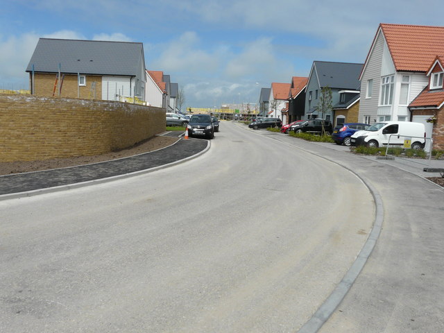
Bramley Way
Bramley Way is a road on a new development of houses, known as Mulberry Place, which is being built on the site of the former TR0625 : Romney Marsh Potato Co Ltd, Cockreed Lane. The wall, on the left, can also be seen in the image of TR0625 : Bramley Way off Cockreed Lane.
Planning permission was approved, with conditions, by Folkestone and Hythe District Council under application number Y10/0698/SH for an outline application for 48 houses and 8 home worker houses (live work) including rotation of an existing dwelling (Greenacres) and off site highway works to Rolfe Lane.
Planning permission was approved, with conditions, by Folkestone and Hythe District Council under application number Y10/0698/SH for an outline application for 48 houses and 8 home worker houses (live work) including rotation of an existing dwelling (Greenacres) and off site highway works to Rolfe Lane.
 Map © Crown Copyright")
TIP: Click the map for more Large scale mapping
- Grid Square
- TR0625, 157 images (more nearby 🔍)
- Photographer
- John Baker (more nearby)
- Date Taken
- Sunday, 11 June, 2017 (more nearby)
- Submitted
- Sunday, 9 July, 2017
- Subject Location
-
OSGB36:
 TR 0657 2560 [10m precision]
WGS84: 50:59.5629N 0:56.5328E - Camera Location
-
OSGB36: TR 0661 2555
- View Direction
- Northwest (about 315 degrees)