TA1028 : River Hull
taken 7 years ago, near to Kingston Upon Hull, England
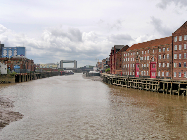
The River Hull is a navigable river in the East Riding of Yorkshire. It rises from a series of springs to the west of Driffield, and enters the Humber estuary at Kingston upon Hull.
Most of its course is through low lying land that is at or just above sea level, causing flooding to be a long-standing problem. Since 1980, the mouth of the river has been protected by a tidal barrier, which can be closed to prevent tidal surges entering the river system and causing flooding.
Wikipedia: Link
Most of the bridges which cross the river are movable, to allow shipping to pass. There are six swing bridges, four bascule bridges, two of which have twin leaves, one for each carriageway of the roads which they carry, and three Scherzer lift bridges, which are a type of rolling bascule bridge. Scott Street Bridge, which is now permanently raised, was originally powered from a high pressure water main maintained by the first public power distribution company in the world.
 Map © Crown Copyright")
- Grid Square
- TA1028, 3428 images (more nearby 🔍)
- Photographer
- David Dixon (more nearby)
- Date Taken
- Monday, 3 July, 2017 (more nearby)
- Submitted
- Monday, 10 July, 2017
- Subject Location
-
OSGB36:
 TA 103 287 [100m precision]
WGS84: 53:44.6134N 0:19.7323W - Camera Location
-
OSGB36: TA 103 289
- View Direction
- SOUTH (about 180 degrees)