2017
SC4088 : View from the Snaefell Mountain Railway
taken 7 years ago, 5 km W of Glen Mona, Isle of Man
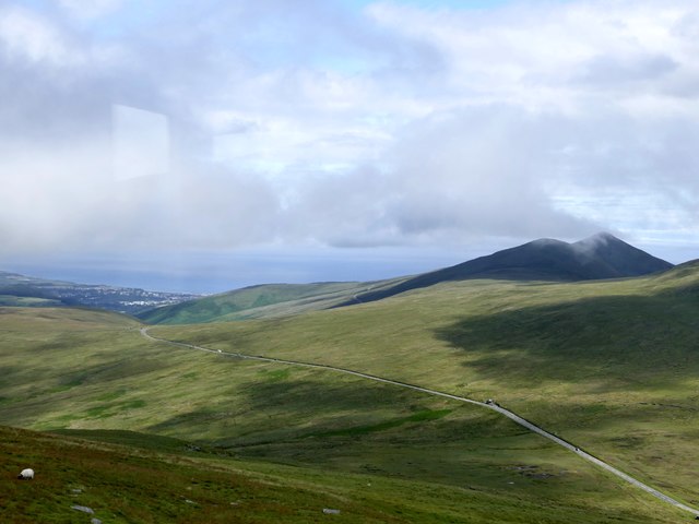
View from the Snaefell Mountain Railway
Looking over the A18 (part of the famous TT course) with Ramsey in the distance.
Snaefell Mountain Railway :: SC3987
Built in 1895, the Snaefell Mountain Railway is an electric mountain railway (the only one in the British Isles) which runs from the village of Laxey to the summit of Snaefell, at 2,036 feet above sea level the highest point on the island. It connects with the Manx Electric Railway (MER) in Laxey. The line is five miles long, built to 3 ft 6 in gauge and uses a Fell Incline Railway System centre rail for braking on the steep gradients. It is electrified using overhead wires at 550 volts direct current, with bow collectors.
LinkOur Transport Heritage
Link
 Map © Crown Copyright")
TIP: Click the map for more Large scale mapping
- Grid Square
- SC4088, 11 images (more nearby 🔍)
- Photographer
- Graham Hogg (more nearby)
- Date Taken
- Wednesday, 5 July, 2017 (more nearby)
- Submitted
- Tuesday, 11 July, 2017
- Subject Location
-
OSGB36:
 SC 405 888 [100m precision]
WGS84: 54:16.2108N 4:27.0311W - Camera Location
-
OSGB36: SC 400 881
- View Direction
- Northeast (about 45 degrees)