2017
TF5801 : Denver Sluice
taken 7 years ago, 3 km from Denver, Norfolk, England
This is 1 of 18 images, with title Denver Sluice in this square
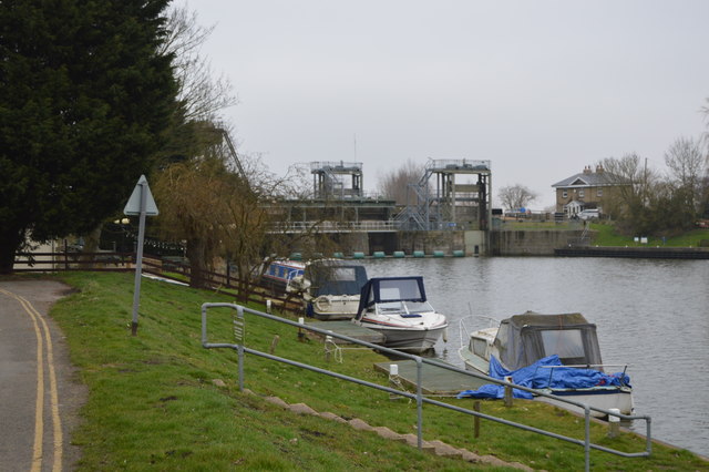
Denver Sluice
The Sluice controls water movement between The River Great Ouse, Bedford River and River Ouse Flood Relief Channel.
A full history can be read at Link
See other images of Denver Sluice
A full history can be read at Link
See other images of Denver Sluice
 Map © Crown Copyright")
TIP: Click the map for more Large scale mapping
- Grid Square
- TF5801, 145 images (more nearby 🔍)
- Photographer
- N Chadwick (more nearby)
- Date Taken
- Saturday, 18 February, 2017 (more nearby)
- Submitted
- Sunday, 16 July, 2017
- Subject Location
-
OSGB36:
 TF 5876 0100 [10m precision]
WGS84: 52:35.0178N 0:20.5107E - Camera Location
-
OSGB36: TF 5874 0083
- View Direction
- NORTH (about 0 degrees)