2017
TM5076 : 28 St James' Green, Southwold
taken 7 years ago, near to Southwold, Suffolk, England
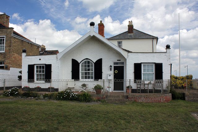
28 St James' Green, Southwold
Early 19th century Grade II Listed house altered in the late 19th century. By 1882 and into the early 20th century to at least 1903 the building was the coastguard station; it is not marked as such on the 1925 OS map. It was subdivided and altered again in the late 20th century.
 Map © Crown Copyright")
TIP: Click the map for more Large scale mapping
- Grid Square
- TM5076, 990 images (more nearby 🔍)
- Photographer
- Jo and Steve Turner (more nearby)
- Date Taken
- Thursday, 15 June, 2017 (more nearby)
- Submitted
- Friday, 21 July, 2017
- Subject Location
-
OSGB36:
 TM 5099 7625 [10m precision]
WGS84: 52:19.6134N 1:40.9229E - Camera Location
-
OSGB36: TM 5098 7623
- View Direction
- North-northeast (about 22 degrees)