2017
SO2613 : National Cycle Network Route 46 signpost, Govilon
taken 7 years ago, near to Govilon, Monmouthshire/Sir Fynwy, Wales
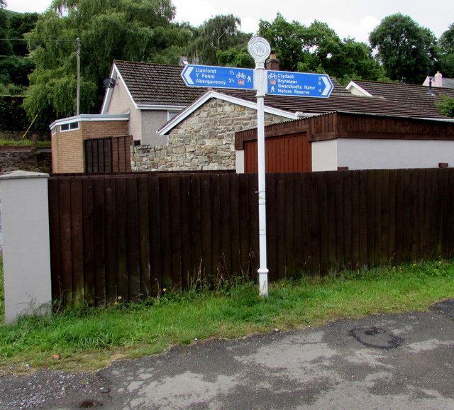
National Cycle Network Route 46 signpost, Govilon
Here opposite the former Govilon railway station, the combined cycle route and footpath uses the trackbed of the former Abergavenny to Merthyr railway. Passenger trains on this route ceased in early January 1958.
The National Cycle Network
The National Cycle Network is a network of cycle routes. It was created by the charity Sustrans Link
(Sustainable Transport), aided by a National Lottery grant.
Many routes aim to minimise contact with motor traffic, though 70% of them are on roads. In some cases the NCN uses pedestrian routes, disused railways, minor roads, canal towpaths, or traffic-calmed routes in towns and cities.
 Map © Crown Copyright")
TIP: Click the map for more Large scale mapping
- Grid Square
- SO2613, 213 images (more nearby 🔍)
- Photographer
- Jaggery (more nearby)
- Date Taken
- Sunday, 23 July, 2017 (more nearby)
- Submitted
- Tuesday, 25 July, 2017
- Subject Location
-
OSGB36:
 SO 2660 1360 [10m precision]
WGS84: 51:48.9713N 3:3.9728W - Camera Location
-
OSGB36: SO 2660 1360
- View Direction
- SOUTH (about 180 degrees)