2017
TQ0273 : Gauging weir on Wraysbury River
taken 7 years ago, near to Hythe End, Windsor And Maidenhead, England
This is 1 of 2 images, with title Gauging weir on Wraysbury River in this square
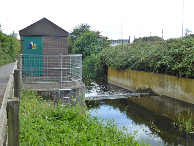
Gauging weir on Wraysbury River
The plate on the door of the hut calls this 'Wraysbury River at Staines Moor Flow Gauging Station. Site reference 2895', together with the almost traditionally inaccurate Environment Agency version of its OS grid reference - TQ02807340.
 Map © Crown Copyright")
TIP: Click the map for more Large scale mapping
- Grid Square
- TQ0273, 56 images (more nearby 🔍)
- Photographer
- Robin Webster (more nearby)
- Date Taken
- Friday, 14 July, 2017 (more nearby)
- Submitted
- Thursday, 27 July, 2017
- Subject Location
-
OSGB36:
 TQ 0289 7363 [10m precision]
WGS84: 51:27.1389N 0:31.2390W - Camera Location
-
OSGB36: TQ 0291 7366
- View Direction
- South-southwest (about 202 degrees)