2017
SK9772 : Ordnance Survey Cut Mark
taken 7 years ago, near to Lincoln, Lincolnshire, England
This is 1 of 3 images, with title Ordnance Survey Cut Mark in this square
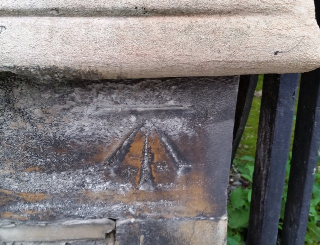
Ordnance Survey Cut Mark
This OS cut mark can be found on the west face of the Bailgate Methodist Church. It marks a point 68.123m above mean sea level.
 Map © Crown Copyright")
TIP: Click the map for more Large scale mapping
- Grid Square
- SK9772, 541 images (more nearby 🔍)
- Photographer
- Adrian Dust (more nearby)
- Date Taken
- Monday, 24 July, 2017 (more nearby)
- Submitted
- Tuesday, 1 August, 2017
- Subject Location
-
OSGB36:
 SK 9767 7207 [10m precision]
WGS84: 53:14.2013N 0:32.2847W - Camera Location
-
OSGB36: SK 9767 7207
- View Direction
- EAST (about 90 degrees)