NT8011 : Sorting the sheep from the goats
taken 7 years ago, 3 km from Blindburn, Northumberland, England
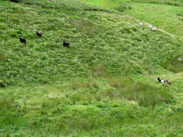
Feral Goats are not native to Britain. They were brought here in Neolithic times (about 5000 BP) as domestic stock, derived from the Bezoar, Capra aegagrus, a native of the Middle East. Most British herds are thought to be the descendants of domesticated stock that were allowed to go feral when sheep replaced goats as the favoured stock of upland farmers during the Middle Ages. The Feral Goats of the Cheviot Hills in Northumberland are thought to be some of the best examples of this primitive type of goat. Their appearance suggests little evidence of cross breeding with modern domestic goats which are bred for increased milk and meat yields and finer quality coats. Primitive British Feral Goats are relatively small, have ears which stand upright, horns in both sexes, and lack the toggles found on the face of modern dairy goats. Coats are long, coarse and shaggy. Colour varies from mostly dark brown to light grey with white patches.
In 2004 there were just three populations of goats in Northumberland. These three populations still exist in the Cheviot Hills on land close to the Scottish Border:
1. The Upper Coquetdale herd centred on The Border land next to the Pennine Way from Wedder Hill to Beef Stand and Mozie Law and the western flanks of Windy Gyle.
2. The north Cheviot population centred around Yeavering Bell and Newton Tors above College Valley.
3. Kielderhead National Nature Reserve (NNR) and Whitelee NNR goats are located between Deadwater and Whitelee.
Natural History Society of Northumbria: Link
Wikipedia: Link
British Feral Goat Research Group: Link
The Guardian, 20th October 2011: Link
 Map © Crown Copyright")
- Grid Square
- NT8011, 18 images (more nearby 🔍)
- Photographer
- Andrew Curtis (more nearby)
- Date Taken
- Monday, 31 July, 2017 (more nearby)
- Submitted
- Tuesday, 1 August, 2017
- Subject Location
-
OSGB36:
 NT 8020 1189 [10m precision]
WGS84: 55:24.0329N 2:18.8515W - Camera Location
-
OSGB36: NT 80281 11934
- View Direction
- West-southwest (about 247 degrees)