1990
SD7273 : Two enclosed fields at Crina Bottom
taken 34 years ago, 3 km from Ingleton, North Yorkshire, England
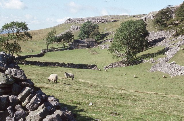
Two enclosed fields at Crina Bottom
Two enclosed fields and a dwelling at Crina Bottom beside the bridleway from Ingleton to the top of Ingleborough.
 Map © Crown Copyright")
TIP: Click the map for more Large scale mapping
- Grid Square
- SD7273, 57 images (more nearby 🔍)
- Photographer
- Philip Halling (more nearby)
- Date Taken
- Tuesday, 25 September, 1990 (more nearby)
- Submitted
- Wednesday, 2 August, 2017
- Subject Location
-
OSGB36:
 SD 7235 7355 [10m precision]
WGS84: 54:9.4207N 2:25.4939W - Camera Location
-
OSGB36: SD 7245 7357
- View Direction
- West-southwest (about 247 degrees)