2017
NT6599 : Isle of May
taken 7 years ago, near to Tarbet Hole [water Feature], Fife, Great Britain
This is 1 of 5 images, with title Isle of May in this square
Isle of May
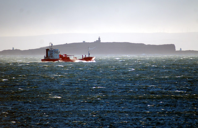
The Isle of May (May Isle) pictured from the former coastguard station at Fife Ness. The Stevenson lighthouse stands prominently mid-isle.
 Map © Crown Copyright")
TIP: Click the map for more Large scale mapping
- Grid Square
- NT6599, 270 images (more nearby 🔍)
- Photographer
- Jerzy Morkis (more nearby)
- Date Taken
- Monday, 3 July, 2017 (more nearby)
- Submitted
- Thursday, 3 August, 2017
- Subject Location
-
OSGB36:
 NT 653 993 [100m precision]
WGS84: 56:11.1253N 2:33.5702W - Camera Location
-
OSGB36: NO 611 090
- View Direction
- South-southeast (about 157 degrees)