2017
SE6051 : High Ousegate
taken 7 years ago, near to York, England
This is 1 of 3 images, with title starting with High in this square
High Ousegate
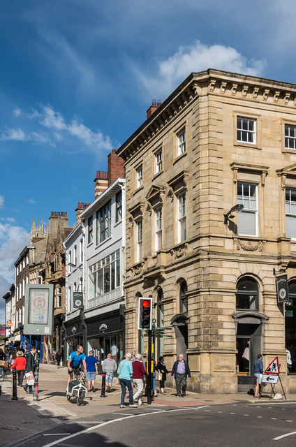
Looking along High Ousegate from its junction with Spurriegate and Nessgate. The building on the corner, 1 Nessgate, was built in 1839 for the Yorkshire Agricultural and Commercial Bank, a company which failed in 1842, although maps suggest that it continued to be used as a bank until at leastthe late 20th Century. It now houses a branch of the clothes retailer, Fat Face. Grade II listed - see Link .
.
 Map © Crown Copyright")
TIP: Click the map for more Large scale mapping
- Grid Square
- SE6051, 3847 images (more nearby 🔍)
- Photographer
- Ian Capper (more nearby)
- Date Taken
- Thursday, 20 July, 2017 (more nearby)
- Submitted
- Sunday, 6 August, 2017
- Subject Location
-
OSGB36:
 SE 603 516 [100m precision]
WGS84: 53:57.4680N 1:4.9273W - Camera Location
-
OSGB36: SE 603 516
- View Direction
- EAST (about 90 degrees)