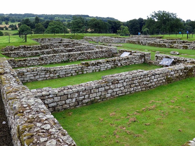
NY9170 : Barracks, Chesters Roman Fort
taken 7 years ago, near to Walwick, Northumberland, England
"O proud Cilurnum, city of the past!
Where are thy legions in their fierce array?
No more, no more the martial trumpets blast
May summon thy plumed cohorts to the fray."
From 'An Ode to the Roman Camp at Chesters, Northumberland' by Frederick Palmer (1912).
Cilurnum (or Cilurvum), the Roman fort on Hadrian's Wall at Chesters marks the point where the Wall crossed the River North Tyne, the first major obstacle on its route from east to west. A succession of finely engineered timber bridges with stone piers spanned the river here, and the Wall itself was continued right down to the water's edge.
The fort was built just after the wall was completed in AD 123. The site guarded a bridge carrying the military road behind the wall across the River North Tyne. It is considered to be the best preserved Roman cavalry fort along Hadrian's Wall.
Today the site is under the care of English Heritage and is open to the public. There is a museum on the site, which houses Roman artefacts found at the fort and elsewhere along the wall.
LinkEnglish Heritage, Chesters Roman Fort
Link
 Map © Crown Copyright")
- Grid Square
- NY9170, 275 images (more nearby 🔍)
- Photographer
- Andrew Curtis (more nearby)
- Date Taken
- Tuesday, 8 August, 2017 (more nearby)
- Submitted
- Wednesday, 9 August, 2017
- Subject Location
-
OSGB36:
 NY 9122 7020 [10m precision]
WGS84: 55:1.5752N 2:8.3325W - Camera Location
-
OSGB36: NY 91217 70218
- View Direction
- South-southeast (about 157 degrees)