2017
SX6479 : Stannon Brook
taken 7 years ago, near to Postbridge, Devon, England
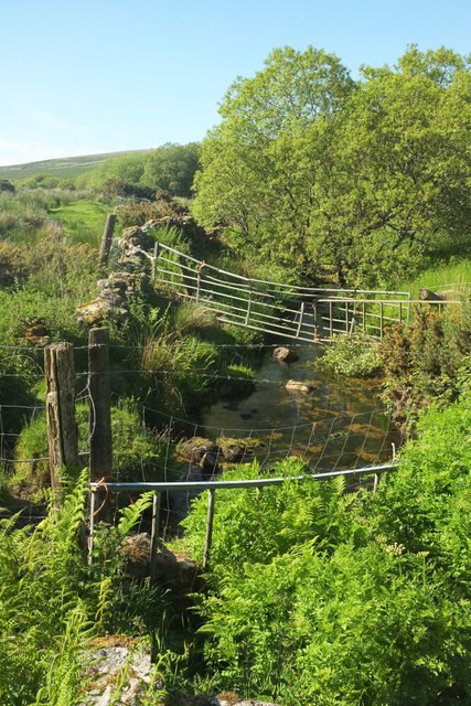
Stannon Brook
Looking upstream (left) from the bridge where SX6479 : Lane to Merripit was taken, with a variety of barriers to dissuade anyone from doing some canyoning up it.
 Map © Crown Copyright")
TIP: Click the map for more Large scale mapping
- Grid Square
- SX6479, 56 images (more nearby 🔍)
- Photographer
- Derek Harper (more nearby)
- Date Taken
- Thursday, 1 June, 2017 (more nearby)
- Submitted
- Thursday, 10 August, 2017
- Subject Location
-
OSGB36:
 SX 6487 7946 [10m precision]
WGS84: 50:35.9505N 3:54.6439W - Camera Location
-
OSGB36: SX 6487 7945
- View Direction
- NORTH (about 0 degrees)